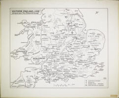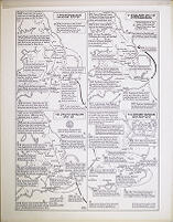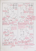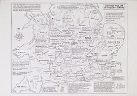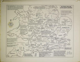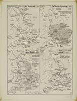
Four maps on one page: The 'Heptarchy' (c. 700), The Mercian Supremacy (c. 800), The Kingdom of the Anglo-Saxons (c. 900), and The Kingdom of the English (c. 1000). Made for the Blackwell Encyclopaedia of Anglo-Saxon England (Oxford, 1999).
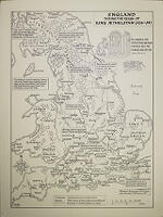
Made in 2001, for the Toller Lecture (2001).
Made in 2008, for the Loyn Memorial Lecture (2008).
Made in 2008, and published in Edgar, King of the English, ed. D. Scragg (Woodbridge, 2008), opp. p. xvi.
The first such map was made in 1999, for a book on Ely Cathedral (2001), but not published. Redrawn in 2011-2012, according to the note on the verso.
The first such map was made in 1999, for a book on Ely Cathedral (2001), but not published.
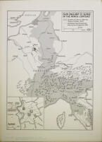
Made in 2000, and published in Europe Around the Year 1000 (Warsaw, 2001), p. 249.
Made in 2006, for an article on King Æthelred’s charter for Eynsham Abbey.
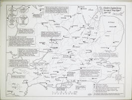
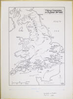
A draft map and a finished map, each depicting four smaller maps on one page: 'I Viking Raids in the 980s', 'IIa The Viking Army in England 991-4', 'IIb The Viking Army in England 997-1000', and '11c The Viking Army in England 1000-5'. Made in 1999, for general purposes.
Relief halftone print from the Supplement to The Gownsman.
Sem títuloFour maps on one page: 'III The Viking Raid of 1006-7', 'IVa Thorkell's Army in England 1009-10', 'IVb Thorkell's Army in England 1010', and 'IVc Thorkell's Army in England 1011-12'. Made in 2002, for general purposes.
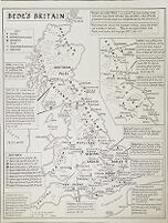
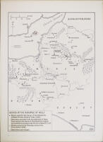
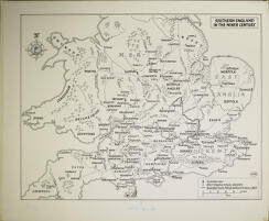
Map showing how Britain is represented in the pages of Bede's Ecclesiastical History, with the addition of some other significant information. Made in 2012 for general purposes.
Relief halftone print from the Supplement to The Gownsman.
Sem títuloFour maps on one page: 'V Swein Forkbeard's Invasion 1013-14', 'VI England 1014-15 Intercission', 'VII Cnut's Invasion 1015-16', 'VIII Edmund Ironside and Cnut 1016'. Made in 2002, for general purposes.
Drafts and photocopies of the three maps of Viking activity.
Relief halftone print from the Supplement to The Gownsman.
Sem títuloMade in 1991, and published in The Battle of Maldon, AD 991, ed. D. Scragg (Oxford, 1991), p. 87.
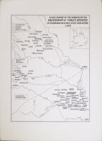
Made in 1997, for reprint of an article published in The York Gospels, ed. N. Barker (London, 1986), p. 85; published in Wulfstan, Archbishop of York, ed. M. Townend (2004), p. 185.
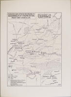
Made in 1996, and published in Anglo-Norman Studies 19 (1997), p. 250.
Made in 1997, for reprint of an article published in Anglo-Norman Studies 10 (1988), p. 194.
Map illustrating Dame Rosemary Cramp's excavations.
Photocopies of some of eleven of the original maps for reproduction for students, accompanied by blank maps on tracing paper and photocopy paper.
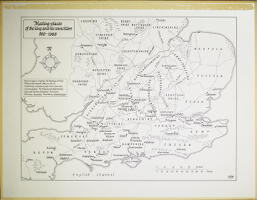
Clofesho was designated the meeting-place for church councils in the late seventh century, and was still used for such purposes in the 820s. Map made in 1994, for The Councils of Clofesho, Brixworth Lecture 1993 (Leicester, 1994).
Made in 2000, and published in Æthelbald and Offa: Two Eighth-Century Kings of Mercia, ed. D. Hill and M. Worthington (Oxford, 2005), p. 9
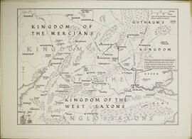
Made in 1998, and published in Alfred the Great, ed. T. Reuter (Aldershot, 2003), p. 187.
Made in 1996, and published in Alfred the Wise, ed. J. Roberts, et al. (Woodbridge, 1997), p. 102.
Made in 1996, and published in Kings, Currency and Alliances, ed. M. A. S. Blackburn and D. N. Dumville (Woodbridge, 1998), p. 32.
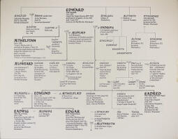
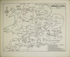
Made in 1998, and published in Edward the Elder, ed. N. Higham and D. Hill (London, 2001), pp. 46–7.